
My first day in Kiribati was rather uneventful. I needed money, so I headed to an ATM. Kiribati has in the neighbourhood of 100 000 people. Around twenty thousand are on Tarawa, and most of those are on the south side. They have no central bank. They haven't got their own money. So they use Australian money and one of the Australian banks has a branch here. Only one, I am told. Plus a couple of ATM's here and there. One was reasonably close to the Otintaai Hotel (pronounced “o-shin-tie), so I headed there. I had been told that the local tourist office was in Betio, and I could get there on a minibus, but as I was walking along, I passed a tour office. So after I got some money from the bank, I made the mistake of going into the tour office. It was a mistake because it was a tour office much like a tour office in North America. They had their own tours and they were rather expensive, and then they added a booking/effort fee on top of that. I don't know whether I would have fared better if I had gone to the tourism office, but after I was done at the Kiribati Holidays office, I had spent the better part of the 500 dollars I had taken out at the ATM. Sigh!! But they did make it so that I didn't have to spend much time working out on my own how to do the things I wanted to do. So even at the premium price, I decided that it was worth it. And what did they set up for me? Well, I'm glad you asked. I heard about a bunch of World War II history here in Kiribati, and that there are lots of relics and remnants left lying about. I wanted to go around and see them. So I set up a tour to do that. It turned out that it was a private tour, which explained the rather high price of it. I also read about the outer island experience. Tarawa is the main island of Kiribati, at least in this western group, the former Gilbert Islands (which in the Kiribati language comes out to Kiribati). It's the seat of government and there are lots of government worker types and all of that here. Lots of immigrants and foreign workers are on this island. To get a taste of how the real Kiribatians live, it is suggested that a person goes to one or more of the outer islands for a few days. So I set up a 2 day stay out on Abaiang. (I couldn't safely make it longer. The flights out and back are only every two days and to stay for 4 days would have me returning on the Sunday, the day before my flight out. With the country being just a bunch of small islands, it would only take a weather disruption which, although unlikely at this time of year wouldn't be impossible, I would not be making my flight. Plus, I want some more time to explore Tarawa on my own.) And I booked a stay in an open-style, Kiribati-type accommodation on the north part of Tarawa. But it is ridiculously expensive. That one makes me shudder. But I will see how it turns out. Once in a lifetime and all that kind of claptrap that we use to justify our ridiculous expenses.
And then I went back to the ATM for more money. :( I'm such an easy target. I spent the afternoon catching up with email and meeting some people here. They are quite friendly.
 The next morning, I met my guide for my tour. Her name was Toka (although I don't know exactly how it's spelled, but it sounded something like that). Joe, who had helped set me up with my stuff to do while here, was along as well. And off we went. There are a lot of questions that I had, and still have to be honest, about what happened. The impression that I got from Toka was that the Japanese were here after they began their Pacific campaign. They pretty much enslaved the Kiribatians and made them do the usual stuff that conquerors who are waging war do, build fortifications, stay away from restricted areas, eat only a little bit and get real thin, and generally do the bidding of the conquerors. It seemed, from what I could gather, that the Japanese were well aware that at some point they were going to be fighting someone for control of the island and the country. They put a bunch of gun emplacements on the beach on the South Tarawa. The beach faces south into the ocean and were well placed to defend against an invasion attempt. This beach is referred to as Black Beach, because the locals were forbidden from going to it, on pain of execution (and probably immediate execution by guards on the beach). These guns have been left in place, rotting and rusting away. There have been attempts to keep them preserved, particularly from the tides, by putting bunkers around them to keep the waves at bay.


There is one gun that was especially troublesome for the invading American and Allied forces. Try as they might, they couldn't take it out of action by just firing on it. So one pilot took it upon himself and took one for the team. He made a suicide run at the gun and smashed it out of action, at the cost of his plane and his life. I'm somewhat dubious, though. Maybe I am overestimating the bulk of fighter planes and all that they carried, but I think if a plane hit a gun that size, it might have done more damage than knocking off the end of the gun. But I wasn't there and so I don't really know.
 After Black Beach, we went to a training center for merchant sailors from Kiribati. One of the main exports from Kiribati is people, not as slaves, of course, but as workers. There aren't many goods that Kiribati produces period, let alone for export. But they have people who can go and earn money and send it back to Kiribati. One of the industries that they can work in is shipping. There is a German operated training facility in South Tarawa that trains sailors for work on cargo ships. In this facility is a remnant of the Japanese occupation. A generator in a bunker in Betio was intact after the Japanese left and was brought, in pieces, to the Marine Training Centre and reassembled. It needed a couple of parts to work, but they weren't available, so a German engineer in the facility made the parts and put the generator together, and today it powers the training centre. So at least one good thing resulted from the Japanese occupation.
 Next it was on to Bairiki, the village/town just before Betio. Here is a cemetery that contains, among the regular dead of Kiribati, a memorial to those that died in the “tragic event” of the 15th of October, 1942. I am unclear on what exactly that event is, and Toka didn't have an answer for it either. (This is that main reason for dissatisfaction with the tour. I had specifically asked if the guide I would have would know the relevant history and events surroundings the sites we would visit, and I was told yes, she would. But then she didn't seem too clear on the events in question, such as at this location. She knew the history, but not some of the apparently key events. And I figures that if I was paying the kind of money I was paying, I was entitled to know things like what had happened on the 15th of October in 1942. I will have to Google it, I suppose. In any case, she made up for it with a very dry sense of humour. We were driving past the Prime Ministers residence at one point and I tried to take a picture. But I was too slow. I got a photo of a post instead. She looked at it and said it was a very nice post. I roared at that, I was so amused. Then she graciously backed up and allowed me to get a better photo.)

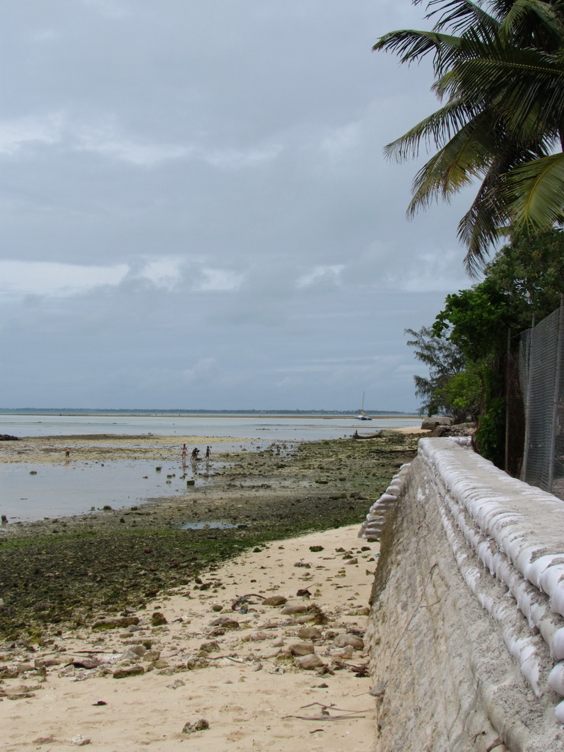
Next it was on to the Betio War Memorial Park. This was at the very southwest corner of South Tarawa. A gun emplacement is there and has a clear view up the Black Beach direction and around the end of the island onto Green Beach, as it is called. It should have handily defended the area against invasion. Maybe the gunner was taking a nap or having a sandwich or something because Green Beach is so named because this is where the Marines landed when the attack was launched, where they made their beachhead, where they gained a foothold on Tarawa that allowed for the re-taking of Tarawa from the Japanese. But the gun should have been able to cut them down without breaking much of a sweat. Instead, it's now a hulking wreck and we are still free. And again, as in the Solomon Islands, actually standing there looking at the whole layout of the area, it really is easy to see how difficult it must have been and to get a sense (albeit slight) of what the Allied forces faced when they made their assault on the Japanese position here. Reading an account of it on the internet doesn't give that same picture.


 Then it was on to the densely populated area of the end of Betio town, where people live in little huts and bungalows all huddled together in a slum-like area. Apparently this is one of the most densely populated spots in the world. But there are twenty thousand people on Tarawa and maybe 8 or ten thousand in this little area of Betio. I would think that Bangladesh and parts of India, among other places would have some kind of density record hands down over what I saw in Betio. And they are much dirtier and have much worse public health conditions. I've never been to those places, but... I guess the experts know better than me.
Passing through this part of Betio, we arrived at another colourfully named beach, Red Beach I. The name of Red Beach came clear as Toka told me that on November 20, 1943, when the Allied forces (and primarily American forces here, from the lists of what type of casualties were suffered in the battle) attacked, they had believed that the ocean would be at low tide. In fact, they were not and the attacking Marines and Navy forces landed and were forced to wade through waist water. The Japanese had anticipated the landing and were hiding in the trees, waiting. And they mowed them down. With the restricted mobility from wading through water, the soldiers were sitting ducks, pun intended. In that initial battle for Tarawa, 1113 Marines and 30 Navy personnel were killed. Another 2290 Marines and 59 Navy personnel were wounded. The beach ran red with blood.
 So did Red Beach II.
And Red Beach III.
 A nearby memorial plaque and time capsule commemorates the battle and the lives lost to it. It stands in the parking lot of the local sports center. The sports center was begun by the Chinese during the previous government, which showed them some favour. But the new administration favoured the Taiwanese and the Chinese apparently left the country in something of a huff. So the Taiwanese finished it.


And near to the US memorial is another memorial with a small gun emplacement. This one is for the Japanese lives lost during the battle. It's behind a fence and isn't accessible. Personally, I found it a bit wrong-headed to have a memorial for the Japanese here in one of the countries they brutalized, and one of the countries that had a decisive battle, that they lost. I'm not saying they shouldn't mourn the loss of their fathers and grandfathers and all. But maybe they should have chosen a different location for a memorial, in a different country? I guess there are a small number of mourners that gather every year to perform some memorial ceremony, and it just seems that would be asking for trouble. But Toka told me that there is never a problem.

 Near Red Beach III is the High Court. Not of the stature you might find in other countries, and you might need directions to find it, but it's here nonetheless.The final official part of the tour was this bunker, headquarters of the Japanese command in the area. The Americans took it out in the end, and apparently the entire commanding group on the island, whereupon the Japanese forces fell into disarray and were quickly defeated. The fence around the area, an attempt to keep the bunker from becoming ruined is apparently only for show. As I was looking at it, a teenager appeared from inside, climbed through a hole in the fence and wandered off into town. The thought's there at least.
 After the bunker, it was time for lunch. We headed to a Chinese restaurant nearby and ordered. As I was looking around, I noticed that Koreans are here, too. Of course, it seemed odd to me that someone had convinced the Chinese proprietor of a restaurant that is in a country that uses Kiribati and English as the local languages to put menu items up in Korean.
 Then it was back off towards my accommodation for the night. Earlier we had passed a number of interesting things that I hadn't had the chance to see well. Toka stopped to let me have a look on the way back. So I got to see the pre-school that Canada built for Kiribati.
Of course, Japan built the parliament house.

 And a causeway linking Betio to the rest of Tarawa. But education is the future, right? And Japan was probably trying to atone for the past anyway.
 And then there was the rather startling sign that suggests that Kiribati is screwed in light of global warming and the melting polar ice caps. I have never been in a country with such a low maximum height above sea level. It is possible that some of the other islands are somewhat higher than this, but it won't be by much.
And then it was to a different, and slightly cheaper guest house, but not by much. It was however, much nicer in other ways and I was able to enjoy a very spectacular sunset.


No comments:
Post a Comment